

BaseMap App Bundle (Solid White, Large)
Product details
| Management number | 212401159 | Release Date | 2026/04/06 | List Price | $36.00 | Model Number | 212401159 | ||
|---|---|---|---|---|---|---|---|---|---|
| Category | |||||||||
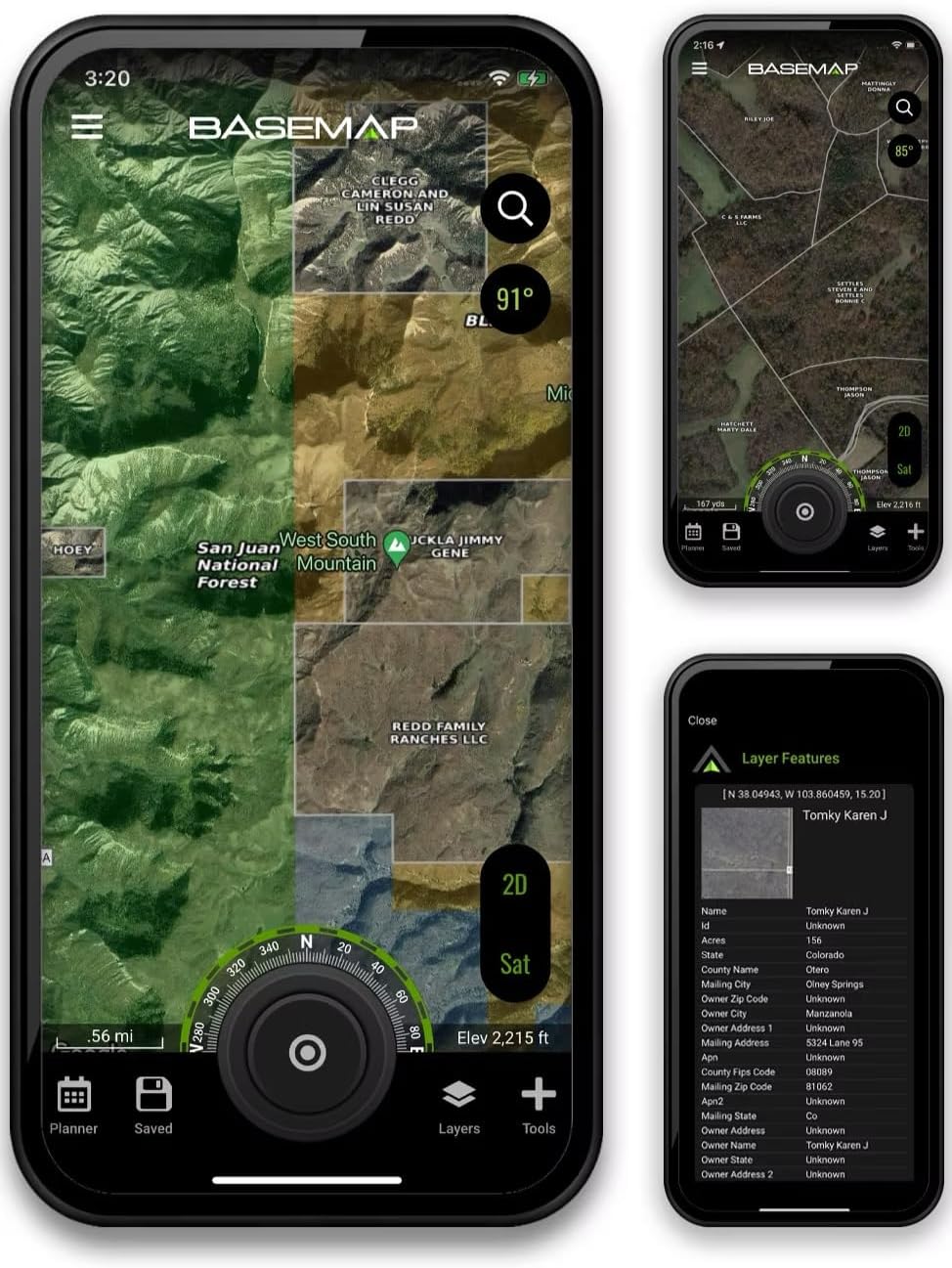
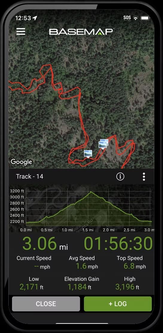
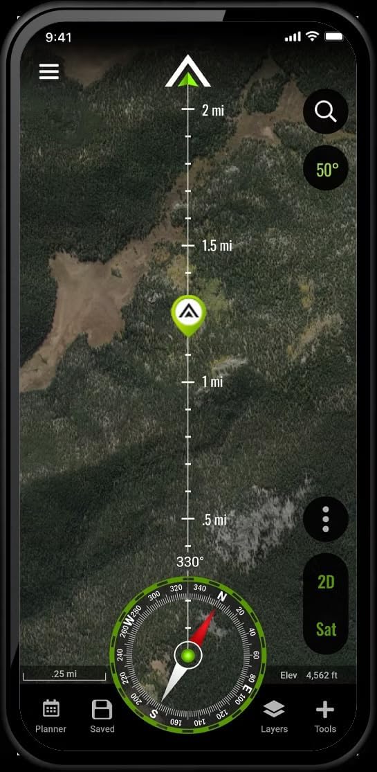
1 year access to BaseMap Pro. and a BaseMap logo cotton T-Shirt! The BaseMap app is the most robust mapping app on the market. It has land ownership maps, navigation, GPS, wind, weather, and field tools all in one convenient app. Compatible with iOS and Android smartphones, simply download and install the app from the Play Store or App Store on your smartphone. OFFLINE GPS and TRACKING Save maps for offline use without service Know exactly where you are in real time even without cellular coverage MAP LAYERS 900 layers and growing Nationwide Color Coded Govt Lands Nationwide Private Parcel Boundaries & Owner Names Coastal Water Depths & over 4,000 U.S. lakes Nationwide Hiking Trails Nationwide Wildfires & Timber cuts Nationwide Wilderness & Roadless Areas State hunting layers (boundaries, WMA’s, habitat, etc) Multiple Topography & Satellite Imagery basemap options Much more ARTEMIS AI (Desktop Only) Ask questions about state regulations and get detailed answers Can provide detailed analysis of hunting tactics for any species Analyzes your map to provide a detailed analysis of hunting tactics, stand placement and more LRF MAPPING (Laser Rangefinder Mapping) Use your rangefinder as a powerful mapping tool Precisely mark the exact location of distant targets with ANY rangefinder Recover game, plan stalks, lookup distant property owners and more, all using your rangefinder MOBILE GPS Know your exact location even without cellular or WiFi service See where you are in relation to landmarks, boundaries, roads, trails, etc Navigate to trailheads, favorite places, markers, or anything you need to locate with our powerful Search and GoTo features. XDR (Exact Direction & Range) NAVIGATION TOOL Easy Point and Go navigation Know the exact distance between you and your destination. HUNTWIND & WEATHER CENTER Wind forecast to better plan your hunt. Know the exact day and time to hunt a particular stand and visualize wind direction and scent drift in relation to your location. Forecasts, temperature, moon phase, sunrise/sunset, wind, and more. LOCATION SHARING Know exactly where your hunting partner is located Real-time updates OUTDOOR JOURNAL Capture, log, and share all your outdoor adventures with the BaseMap community Real-time location sharing so friends can see where you are in case of emergency (connection reqd.) SmartMarkers - Automatically capture the weather conditions at the time you add a marker. HARVEST LOG Log your hunts as detailed as you'd like. Record your hunt type, species/size, weapon, unit/GMU & much more. GOOGLE EARTH INTEGRATION Export markers and view them right in Google Earth View the terrain in true 3D Our Unisex Cotton Crew Tee, a perfect blend of comfort and style. This classic fit tee provides a laid-back vibe, making it an essential piece for any wardrobe. Made from 100% combed, ring-spun cotton, it offers a soft feel against the skin, making it suitable for everyday wear. Whether you're lounging at home, meeting friends, or heading to a casual gathering, this tee fits seamlessly into your lifestyle.
- Unisex Cotton Crew Tee, a perfect blend of comfort and style
- The most robust mapping app on the market
- Public and private landownership map layers
- GPS navigation, compass feature, location tracking and exact distance and range to keep you on track
- Offline downloadable maps for when there is no cell service
- Satellite Imagery, Hybrid (Satellite and topo lines) and Topographical basemap layers
- Location sharing to keep your friends, family, hiking partners or hunting partners appriased of your location.
- Works on most iOS and Android devices for in the field opperation. Web application for planning trips and scouting from your laptop or desktop computer.
| Brand | Generic |
|---|---|
| Item Weight | 5 Ounces |
| Manufacturer | BaseMap |
| BuiltIn Media | 1 T-shirt |
| Item Dimensions | 29 x 1 x 28 inches |
| Compatible Devices | Ios Smartphones, Android Smartphones, Iphone, Android Phone, Mobile Devices |
| Enclosure Material | Cotton |
| Additional Features | Real Time Tracking |
| Supported Application | Hunting, Hiking, Outdoor Recreation, Navigation, Land Ownership Research, Wildlife Tracking, Weather Monitoring, Trip Planning, Emergency Location Sharing, Outdoor Adventure Logging |
| Connectivity Technology | Bluetooth, Cellular, Wi-Fi |
| Specific Uses For Product | Hiking, Hunting, Outdoor Recreation |


Bestseller ranking
Dash Hardware & Trim

Customers who viewed this product also viewed
Great Value garnishes

Correction of product information
If you notice any omissions or errors in the product information on this page, please use the correction request form below.
Correction Request Form