
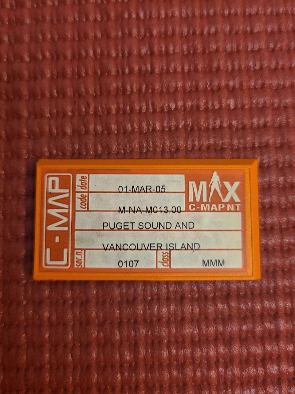
C-MAP MAX electronic navigational chart cartridge for Puget Sound & Vancouver Is
$92.37
Price when purchased online
Free shipping
Free 30-day returns
Sold and shipped by the3dwallet.com
We aim to show you accurate product information. Manufacturers, suppliers and others provide what you see here.
$92.37
Price when purchased online
Free shipping
Free 30-day returns
Sold and shipped by the3dwallet.com
Free 30-day returns Details
Product details
| Management number | 813004 | Release Date | 2025/07/07 | List Price | $64.66 | Model Number | 813004 | ||
|---|---|---|---|---|---|---|---|---|---|
| Category | |||||||||
This is a C-MAP MAX electronic navigational chart cartridge for Puget Sound and Vancouver Island. March 2005 It's used with compatible chartplotters to provide detailed maps and navigation information for boaters in the area.

Bestseller ranking
Boating


Correction of product information
If you notice any omissions or errors in the product information on this page, please use the correction request form below.
Correction Request Form